Miami County, Kansas Townships and the Patterns of Early Settlement
The Survey That Organized a County
Before a single farmstead was legally claimed in Miami County, surveyors working under federal contract had already divided the land into a precise geometric grid. The Public Land Survey System — the federal method for measuring and subdividing public domain lands that Thomas Jefferson’s Land Ordinance of 1785 had established — mapped eastern Kansas in the early 1850s, laying out the township-and-range coordinates that would determine property boundaries for the next 170 years.
The survey divided the land into townships six miles square, each containing 36 one-square-mile sections. Sections were numbered in a standard pattern, allowing any quarter of any section — 160 acres — to be identified precisely by its legal description: a quarter-section designation, section number, township number, and range number. When Kansas Territory was organized in 1854 and Miami County established in 1855, this survey framework was already in place. The county’s settlers were not choosing land randomly; they were selecting specific parcels within a system designed to create clear, unambiguous ownership records across an entire continent.
Township Organization and Local Government
Miami County’s civil townships are the county’s smallest units of formal government. Each township has elected township trustees — typically three — and a township clerk who manage the minimal but genuine governmental functions that Kansas law assigns to the township level. Road maintenance across the rural road network has been the primary township responsibility since the 19th century: the section-line roads that form Miami County’s rural grid are township roads, and their condition has always depended on the resources and attention of local township government.
The township trustee board also handled property tax assessment in the county’s earlier history, collected certain taxes, administered poor relief for township residents, and maintained voter registration lists. The township meeting — an annual gathering of township residents at which trustees reported on expenditures and residents could raise concerns — was a basic unit of democratic participation for farm families throughout the late 19th century. For a farmer in a rural Miami County township, township government was often the most proximate governmental institution in daily life.
Township boundaries were established at county organization and have generally remained stable, though boundary adjustments occurred as surveys were refined and population shifted. The regularity of the township grid meant that Miami County’s local government geography was unusually legible: every resident knew which township they lived in, which section they farmed, and how their land related spatially to neighboring farms and communities.
Settlement Patterns and the Grid’s Influence
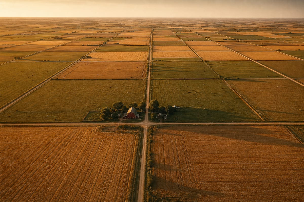
The federal survey grid shaped how Miami County was settled in ways that distinguish it from eastern states where land was distributed under metes-and-bounds surveys tied to natural features. In Miami County, farms were rectangular. Roads ran straight and intersected at right angles along section lines. Rural communities formed at the crossing points of section-line roads where traffic naturally concentrated.
The typical Miami County farm claim in the county’s first decade was a quarter-section of 160 acres, the standard unit under the Preemption Act that allowed settlers to claim land before public auction at a fixed price per acre. Families arriving in the late 1850s and early 1860s selected their quarter-sections based on soil quality, proximity to water, access to timber, and neighborhood — the social consideration of who one’s neighbors would be was not trivial in the early settlement period, when mutual assistance was essential for farm establishment.
The Civil War era disrupted settlement patterns significantly. Miami County’s position on the Missouri border made it a contested zone during the Bleeding Kansas period, and the guerrilla warfare of the Civil War years — including Quantrill’s Raid in 1863 — depopulated some areas of the county temporarily. Settlement that had been underway since 1855 was interrupted, and some early claimants abandoned their land. The post-war decade saw renewed settlement as returning veterans and new arrivals from the eastern states filled in sections that had been left unclaimed or abandoned.
The Physical Landscape of the Township Grid
The section-line road system that the township grid created is visible today in Miami County’s rural landscape. County roads running in ruler-straight north-south and east-west alignments, intersecting at consistent one-mile intervals, trace the survey geometry that federal surveyors established in the 1850s. The farmsteads positioned along these roads — placed to face the road while maximizing field access — reflect a settlement pattern that the grid organized at a scale of individual parcels and sections.
Rural churches and schoolhouses in Miami County were typically positioned at or near section-line road intersections where they could serve the maximum radius of township residents. A church at a township crossroads could draw attendance from four townships’ worth of surrounding farms, each a different quarter of the surrounding sections. The rural school district boundaries, which were overlaid on the same township geography, followed similar logic: position the schoolhouse where the walking distances for the surrounding farm children were roughly equal.
The township’s relationship to railroad development added another layer to the settlement geography. When the railroads reached Miami County in the early 1870s, they did not follow section lines — they followed terrain and engineering logic. This meant that railroad towns like Paola and Louisburg were not simply grid intersections but functional centers that drew economic activity away from the purely geometrical crossroads pattern. The result was a mixed geography: a regular grid of farms and roads overlaid with the organic lines of rail corridors and river valleys.
Land Records and the Township System
The township grid’s most durable legacy is the system of land records it created. Every property transaction in Miami County from 1855 forward carries a legal description in PLSS format — township, range, section, and quarter-section — that locates the property precisely within the survey coordinate system. This consistency makes Miami County land records unusually tractable for historical research: a 19th-century deed and a modern property record describe land in the same geometric language, and the relationship between any two parcels can be determined from their legal descriptions alone.
For genealogical researchers tracing Miami County families, land records are among the most useful sources for establishing family movements, farm locations, and economic standing. The Bureau of Land Management’s General Land Office Records database provides free access to digitized original patents for Miami County, showing who first received federal title to each section and quarter-section. Subsequent transactions — purchases, mortgages, inheritances — are documented in the Miami County Register of Deeds. Together, these records can trace a family’s land history from first claim to sale across multiple generations, providing a spatial anchor for the broader family narrative.
The township system also created the administrative geography within which school districts and church congregations organized themselves. Township trustees maintained road records that documented which families held which farms along which roads. Township assessment rolls recorded property values and thus family economic standing across decades of county history. The township, in short, was not merely a surveying artifact — it was the organizing frame within which Miami County’s rural community conducted its daily life for the first century of the county’s existence.