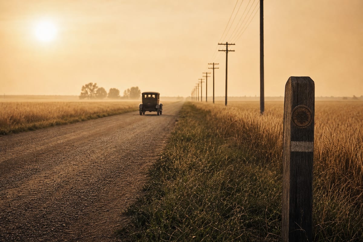
The Jefferson Highway Through Miami County, Kansas
Roads Before the Automobile
In the first decade of the 20th century, the roads of eastern Kansas were built for horses and wagons, not for motor vehicles. The county road system that criss-crossed Miami County connected farms to towns and towns to county seats, but the roads were unpaved, seasonally impassable, and designed for the pace and weight tolerances of draft animal transportation. A journey between Paola and Kansas City by road was a serious undertaking, measured in half-days rather than hours.
The automobile arrived in rural Kansas during the 1900s and 1910s, initially as a curiosity of the prosperous few, but rapidly becoming a practical transportation option as manufacturing costs fell and road networks improved. The challenge was that the road network had not been designed with automobiles in mind. Early motorists faced unmarked routes, conflicting local road names, and a complete absence of the directional signage or surface improvement that motor vehicle travel required.
The named highway movement emerged from this gap between the automobile’s potential and the inadequacy of the existing road system. Private associations of business leaders, civic boosters, and automobile enthusiasts organized to designate, map, and promote specific routes — and to lobby local governments for the road improvements that would make those routes usable by motor vehicles.
The Jefferson Highway Association and the 1915 Establishment
The Jefferson Highway Association was organized in 1915 to establish and promote a north-south route connecting Winnipeg, Manitoba with New Orleans, Louisiana. The name honored President Thomas Jefferson, and the choice was deliberate: Jefferson had presided over the Louisiana Purchase of 1803, which had brought the land through which the highway would pass into the United States. The highway’s promoters positioned it as a route through the heart of Jefferson’s American expansion.
The Association’s founding meeting brought together representatives from multiple states and Canadian provinces along the proposed corridor. Kansas was a central segment of the route, linking the Kansas City metropolitan area to the southern states via a highway that would run through the agricultural heartland. The Association designated the route, produced maps, and installed the distinctive shield-shaped markers that identified Jefferson Highway roads to travelers.
The named highway model worked through coordination rather than construction. The Association did not build roads — it designated existing roads, lobbied for improvements, and publicized the route to generate traffic that gave local governments an incentive to maintain and upgrade the road surface. A town on a named highway had an economic interest in keeping that highway passable, because travelers meant business for local hotels, garages, and merchants.
The Route Through Kansas and Miami County
The Jefferson Highway’s Kansas alignment followed the eastern corridor of the state, threading through the agricultural and commercial towns of the Osage Plains. The route entered Kansas from Missouri near the Kansas City area and proceeded southward through eastern Kansas, passing through communities that would benefit from the tourist and traveler traffic the highway generated.
Miami County lay directly in this corridor. The highway’s route through the county followed road alignments that connected Paola and the surrounding towns to the broader north-south axis, placing Miami County on one of the country’s earliest named transcontinental routes. For a county whose primary transportation link had been the railroad, the Jefferson Highway represented a parallel development — a road-based network that promised similar connectivity but through a completely different technology and infrastructure model.
For towns along the route, designation as a Jefferson Highway community carried commercial significance. Travelers planning a journey from Kansas City to Oklahoma or Texas would consult Jefferson Highway maps, and the towns listed on those maps had a first-mover advantage in establishing the roadside service infrastructure — filling stations, tourist camps, diners, and repair garages — that automobile travel required.
Impact on Towns Along the Route
The arrival of sustained automobile traffic through Miami County in the mid-1910s and 1920s created new economic opportunities that were distinct from, and in some ways complementary to, the railroad economy. The railroad had made long-distance bulk freight movement economical; the highway made casual individual travel possible for anyone who owned a car.
Main Street businesses in Paola and Louisburg could capture Jefferson Highway travelers in ways that the railroad economy had not enabled. A traveler passing through by car might stop for fuel, a meal, or overnight lodging in ways that a train passenger, locked into a fixed schedule and a distant terminus, could not. The early automobile tourism economy was built on exactly this kind of opportunistic stopping, and towns on named highways had a structural advantage in capturing it.
The highway also changed the geography of local commerce. Farmers who had depended on the railroad depot as the organizing point of their market connections found that the automobile gave them access to a broader range of destinations. A farmer with a truck could now reach Kansas City or Emporia directly, bypassing the railroad for short-haul trips and gaining flexibility in when and where to sell.
The 1926 Federal Numbering System and Its Aftermath
The named highway system’s organizational logic was superseded in 1926 when the American Association of State Highway Officials, working with the federal Bureau of Public Roads, established the federal numbered highway system. The new system assigned standardized numbers to major routes across the country — US Highway 66, US Highway 40, US Highway 30 — and replaced the private association markers with uniform federal shields.
The transition was not entirely smooth. Named highway associations had invested years of organizational effort and promotional resources into their routes, and some resisted the replacement of their distinctive branding. But the federal system’s advantages in clarity and official backing ultimately prevailed, and by the late 1920s most named highway markers had been superseded.
For the Jefferson Highway’s Kansas corridor, the 1926 reorganization brought absorption into the federal numbered system. Portions of the Jefferson Highway route in eastern Kansas became part of US Highway 69, the north-south artery that continues to run through Miami County today. US-169, the improved modern alignment of the same corridor, carries the successor traffic to the route that the Jefferson Highway Association designated more than a century ago.
Heritage Preservation
The Jefferson Highway has benefited from organized historical preservation efforts that have kept the name and concept alive for automobile history enthusiasts. State-level Jefferson Highway associations in several states have worked to document the original route alignment, install commemorative markers, and promote driving the historic corridor as a heritage travel experience.
In Kansas, the US-69 corridor through eastern Kansas represents the Jefferson Highway’s functional successor, though the modern highway’s improvements — four-lane sections, grade separations, limited access interchanges — have substantially altered the travel experience compared to the two-lane road that 1915-era motorists navigated. The physical corridor, however, remains recognizable, and the communities it passes through retain the character of towns that grew up around both rail and early highway transportation.
Miami County’s position on the Jefferson Highway route is part of a larger story about eastern Kansas’s place in American transportation history — a region that experienced the railroad era, the named highway era, and the federal highway era in sequence, with each transition reshaping the county’s connections to the wider economy and the world beyond its borders.