Paola, Kansas: County Seat and Heritage of Miami County
Paola, Kansas, has stood as the seat of Miami County government for more than 170 years. Founded in 1855 at the eastern edge of what would become one of the nation’s most contested territories, the city has witnessed transformations that mirror the broader arc of American history — from violent frontier conflict to railroad prosperity, from agricultural consolidation to the steady rhythms of small-city civic life. Its courthouse square, its churches, its schools, and its streets all carry traces of that long passage.
Geography and Setting
Paola occupies a place on the eastern edge of the Great Plains, where the landscape softens from the open prairie into the gently rolling terrain of the Osage Plains. The city sits at roughly 900 to 950 feet above sea level in Miami County’s eastern reaches, within the broader drainage basin of the Marais des Cygnes River — a waterway whose French name, given by early trappers, translates loosely as “marsh of the swans.” That river and its tributaries shaped the settlement patterns of the region, providing water for livestock and early milling operations and defining the natural corridors through which travelers and traders moved.
Miami County itself occupies the northeastern corner of Kansas, sharing its eastern boundary with the Missouri state line. Paola lies approximately 50 miles south of Kansas City, Missouri, a proximity that has shaped the city’s economic life throughout its history. The town is served by US Highway 169, which follows one of the region’s oldest travel corridors and connects Paola northward to the Kansas City metropolitan area and southward toward Coffeyville and the Oklahoma border.
The terrain around Paola is characteristic of eastern Kansas: creek bottoms lined with hardwood timber, upland fields given over to row crops and pasture, and a horizon that stretches wide in every direction. In the 19th century, this landscape was ideal for the mixed farming economy that sustained the county, combining grain cultivation with livestock raising in proportions that varied decade by decade as markets and technologies shifted.
Native Nations and Treaty Lands
Before American settlers arrived in force, the land that would become Miami County was part of a larger geography shaped by federal Indian policy and the displacement of Native nations from their eastern homelands. The Miami (Myaamia) people, an Algonquian-speaking nation from the Great Lakes region, were relocated to Kansas territory in the 1840s following treaties that extinguished their land claims in Indiana. They held a reservation in the region that gave the county its eventual name.
The Peoria Tribe — a confederacy of several related Algonquian groups, including the Peoria, Kaskaskia, Wea, and Piankeshaw — also held treaty lands in the area. These nations had experienced successive removals from their original territories across the Old Northwest, arriving in Kansas territory as that region itself was about to be opened to American settlement. The presence of these nations was not incidental to Paola’s founding; their treaty rights, the negotiations surrounding those rights, and the eventual extinguishment of their Kansas land claims were bound up in the same political moment that produced the Kansas Territory itself.
The Peoria chief whose name was attached to the new town — Paola — was one of the recognized leaders of the confederacy at the time of settlement. The choice to name the county seat after this figure reflected both the practical reality of Native presence in the region and the social conventions of mid-19th-century American town naming, in which Indigenous names were frequently applied to new settlements as a form of geographic labeling even as the nations themselves were marginalized. The full story of how Paola got its name is documented separately.
The Kansas-Nebraska Act and the Birth of Miami County
The political event that made Paola possible was the Kansas-Nebraska Act of 1854, which Congress passed after months of sectional conflict. The act organized Kansas and Nebraska as territories and introduced the principle of popular sovereignty — the idea that settlers in a territory would vote to decide whether slavery would be permitted upon statehood. The practical consequence in Kansas was an immediate and violent contest between pro-slavery and free-state factions for control of the territory’s political institutions.
Miami County was formally established by the Kansas territorial legislature in 1855, one of the first counties organized in the new territory. Paola was platted and established in the same year, and it was designated the county seat essentially from the outset. The town’s founders laid out a conventional grid of streets around a central square reserved for the courthouse — a spatial pattern borrowed from the courthouse-square tradition common in the states from which many settlers had come, particularly Missouri, Kentucky, and Ohio.
The founding of Paola in 1855 placed it at the epicenter of what would become known as Bleeding Kansas — the period of guerrilla violence, electoral fraud, and political crisis that lasted from 1854 until Kansas achieved statehood in 1861. The territory became a testing ground for the slavery question, and Miami County was not spared the tensions of that period.
Bleeding Kansas: Paola and the Border Crisis
The Bleeding Kansas years left an indelible mark on the region. Miami County’s position along the Missouri border made it particularly vulnerable to the cross-border raids and reprisals that characterized the conflict. To the north and west of Paola, communities like Osawatomie became synonymous with abolitionist resistance — John Brown’s name is closely associated with that town following the Battle of Osawatomie in August 1856, in which proslavery forces attacked the settlement and Brown’s son Frederick was killed.
Paola occupied a more commercially oriented position in the conflict. The town drew settlers from Missouri and the border South as well as from the northern states, and its population reflected the divided loyalties of the region. As the county seat, it was the site of the territorial government’s administrative functions, and control of those functions — the courts, the land offices, the tax records — was itself a prize in the political struggle between factions.
The fraudulent elections that plagued the Kansas Territory during this period directly affected Miami County. Pro-slavery forces attempted to dominate the territorial legislature through orchestrated ballot stuffing, with Missouri “border ruffians” crossing into Kansas to cast illegal votes. Free-state settlers organized their own parallel government and refused to recognize the results. The competing constitutional conventions — the pro-slavery Lecompton Constitution and the free-state Topeka Constitution — represented the territory’s unresolvable political crisis, and the towns of eastern Kansas, including Paola, were caught between those competing claims to legitimacy.
By the late 1850s, the free-state position was gaining the upper hand in the territory, and when Kansas was admitted to the Union on January 29, 1861 — as a free state — Miami County and Paola were formally incorporated into the framework of American constitutional government on the winning side of the slavery question.
The Civil War Era
Kansas entered the Union just months before the attack on Fort Sumter in April 1861 initiated the Civil War. For a border county like Miami County, the war meant something different than it did for states farther from the front lines. Missouri, directly across the eastern border, was a slave state that remained officially in the Union while being torn by guerrilla conflict between Unionist and Confederate-sympathizing factions throughout the war. That proximity brought the violence close.
The most catastrophic episode came in August 1863, when Confederate guerrilla leader William Quantrill led approximately 400 raiders in a devastating attack on Lawrence, Kansas — a free-state stronghold roughly 40 miles north of Paola. The Lawrence Massacre killed approximately 150 to 200 civilians and burned much of the town. The raid sent shockwaves through eastern Kansas, and communities across the region, including Paola, braced for similar attacks.
Union General Thomas Ewing Jr. responded to the Lawrence Massacre with General Order No. 11, which forced the depopulation of several Missouri border counties to eliminate the civilian support network for guerrillas. The order’s implementation and the retaliatory violence it prompted further destabilized the region and deepened the bitterness between Kansas and Missouri communities that persisted for generations after the war.
Men from Miami County served in Kansas regiments throughout the war. The county contributed to several Kansas volunteer infantry and cavalry units, and some residents with Southern sympathies crossed into Missouri to serve Confederate forces. The war divided families and communities across the border region in ways that defied simple geographical lines.
When the war ended in 1865, Miami County and Paola turned toward the work of reconstruction and economic development. The violence was over, but the memories remained, and the political culture of eastern Kansas carried the imprint of the border war experience for decades.
The Courthouse and County Government
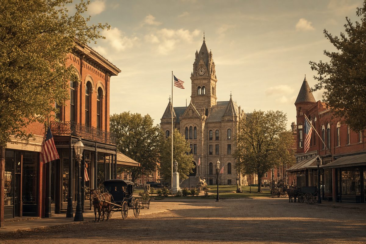
The courthouse square at the center of Paola has been the city’s defining spatial feature since the town’s founding. The original county government operated from improvised facilities in the mid-1850s, as was common in frontier county seats where permanent buildings took years to materialize. As Paola grew through the 1860s and into the 1870s, the need for a permanent courthouse became pressing.
The current Miami County Courthouse represents a later generation of building on the central square. Constructed in the late 19th century, the structure reflects the architectural ambitions of a county that had achieved a measure of prosperity and stability after the tumultuous founding decades. Its brick construction, characteristic of the period’s civic architecture in Kansas, was a deliberate departure from the frame buildings that dominated the earlier townscape — a statement in masonry that the county intended permanence.
The courthouse square around which Paola’s commercial district organized itself follows a pattern common across the Midwest and Upper South: a public block set aside for government buildings, surrounded by commercial streets where merchants, lawyers, doctors, and other businesses clustered. This arrangement gave the square a dual character as both civic center and commercial hub, with the rhythms of court terms and county business drawing residents from across the county into town on a regular basis.
County courts have held session in Paola continuously since 1855. Land records, probate filings, court judgments, marriage licenses, and tax rolls accumulated in the courthouse over the decades, creating an archival record of the county’s history that researchers can still consult today through the Kansas State Historical Society and the county’s own records.
The Railroad Arrives
The arrival of the railroad transformed Paola, as it transformed nearly every town in the post-Civil War Midwest. Rail connections meant access to distant markets, lower freight costs, faster mail, and the possibility of attracting industries that required reliable transportation. For an agricultural county like Miami County, the railroad meant that farmers could ship grain and livestock directly to Kansas City and beyond, rather than depending on the slow and expensive overland haul to river landings.
The Missouri, Kansas and Texas Railway — universally known as the “Katy” — was among the rail lines that served the Paola area. The Katy was one of the first railroads to push southward from Kansas into Indian Territory, and its construction through the region in the early 1870s opened new commercial possibilities. Rail connections linked Paola to the broader network of the national economy and positioned Miami County’s agricultural output for competitive markets.
The railroad brought more than freight capacity. It brought new residents attracted by economic opportunity, new goods available in local stores, and a tightening of the connections between Paola and the wider world. The late 19th century saw the construction of the commercial buildings that still define much of Paola’s downtown — brick storefronts built to serve a growing population with money to spend, professionals with clients to attract, and merchants with goods to sell.
The railroad also accelerated the integration of Miami County into the grain economy of the Great Plains. Wheat and corn became the dominant cash crops, supplemented by hog and cattle production that could now be shipped efficiently to the packing houses of Kansas City. Grain elevators rose along the rail lines, and the agricultural infrastructure of the county took the shape it would hold for most of the following century.
The Ursuline Sisters and Catholic Education
Among the most consequential institutions established in Paola’s history was the educational network built by the Ursuline Sisters, a Roman Catholic religious order with roots in 16th-century Italy and a long tradition of founding schools for girls and young women. The Ursulines arrived in Paola in the 1870s, part of a broader expansion of Catholic educational institutions across the American Midwest during the decades following the Civil War.
The order established a school in Paola that drew students from Catholic families throughout Miami County and the surrounding region. At a time when public education remained limited in scope and quality in many rural areas, the Ursuline school offered a structured curriculum with trained teachers and a physical facility dedicated to learning. The institution’s presence reflected both the growth of the Irish and German Catholic immigrant populations in eastern Kansas and the organizational capacity of the Catholic Church to establish lasting institutions in new communities.
The Ursuline presence in Paola shaped the city’s religious and cultural landscape for generations. The order’s school served the community through multiple generations of students, and its graduates carried the influence of that educational tradition into the professional and civic life of Miami County. The order’s commitment to education for women was particularly significant in a period when opportunities for formal schooling for girls were uneven across the region.
The broader Catholic community in Paola organized around the parish structure that grew alongside the Ursuline educational mission. Catholic churches became among the most substantial religious buildings in the city, and the Catholic population’s presence gave Paola a denominational diversity that enriched its social fabric beyond the predominantly Protestant traditions of the early settlement period.
Late 19th Century Growth and Civic Development
The decades between the end of the Civil War and the turn of the 20th century were the period of Paola’s most rapid growth and institutional development. The population expanded as the county’s agricultural economy matured and as rail connections brought new commercial activity. The civic infrastructure that small cities across the Midwest built during this era — schools, churches, fraternal organizations, newspapers, banks, and professional offices — took shape in Paola during these years.
The city’s newspaper history extended back to the territorial period. Local newspapers served as essential institutions in 19th-century American towns, providing the flow of commercial and political information that connected residents to each other and to the wider world. Paola’s newspapers through the late 19th century documented the city’s development in their advertising columns and news pages — recording the opening of new businesses, the decisions of county government, the outcomes of local elections, and the social events of the community. These newspapers survive in fragmentary form in the archives of the Kansas State Historical Society and constitute one of the primary sources for understanding Paola’s history during this formative period.
Protestant congregations also expanded and built permanent church facilities during these decades. Methodist, Presbyterian, Baptist, and other denominations established congregations in Paola that reflected the religious backgrounds of the settlers who had come from the eastern states. The construction of substantial church buildings — often among the most architecturally ambitious structures in any small city — was a statement of permanence and community investment. Several of these 19th-century church buildings survived into the 20th century and some into the present, serving as architectural anchors in Paola’s historic streetscape.
Fraternal organizations played an important role in the social life of late 19th-century Paola, as they did in virtually every American town of the period. The Masons, the Odd Fellows, the Grand Army of the Republic (for Civil War veterans), and other organizations provided men with networks of mutual support, social connection, and civic identity. Women’s organizations, including church auxiliaries and literary societies, performed analogous functions for the female half of the community.
Banking and Commerce
A functioning commercial economy required financial institutions, and Paola developed a local banking sector during the latter half of the 19th century. Banks provided credit to farmers purchasing land and equipment, to merchants expanding their inventories, and to builders constructing the commercial and residential buildings that gave the city its physical form. The availability of credit was essential to the agricultural expansion of the period, and local banks served as the intermediaries between the capital markets of the East and the borrowing needs of the Kansas frontier.
The commercial district around the courthouse square developed a layered complexity during this period. General merchandise stores gave way over time to more specialized retail establishments as the local market grew large enough to support specialization. Hardware stores, dry goods merchants, drug stores, and professional offices occupied the brick buildings that replaced earlier frame structures as the city’s commercial prosperity allowed for more permanent construction.

The 20th Century: Consolidation and Continuity
The 20th century brought Paola a more measured pace of change. The rapid growth of the founding decades gave way to a more stable pattern of gradual development as the agricultural economy matured and as the broader forces of urbanization drew population toward larger cities. Miami County’s proximity to Kansas City meant that residents had access to metropolitan amenities relatively easily, which moderated the pressure to develop those amenities locally but also meant that Paola competed with the metropolitan area for population and economic activity.
The automobile transformed Paola, as it transformed every American city and town in the first decades of the 20th century. Roads were improved, and the geography of daily life expanded to encompass distances that had been impractical in the horse-and-wagon era. The automobile brought the county’s rural population into Paola more easily for shopping and services, but it also made it easier for Paola residents to travel to Kansas City for goods and entertainment not available locally. The net effect was a gradual integration of the county into a wider regional economy centered on the metropolitan area.
The Depression years of the 1930s hit Miami County’s agricultural economy hard, as they did farm communities across the Great Plains. Falling commodity prices, drought, and bank failures compressed the county’s economic life and forced adjustments in farming practices and business operations. Federal New Deal programs reached Miami County through agricultural price support programs and public works projects that provided employment and improved local infrastructure.
World War II brought new demands on the county’s population. Miami County men served in the armed forces in both the European and Pacific theaters, and the wartime economy drew some residents away permanently to defense industries in Kansas City and other cities. The postwar years brought the prosperity that characterized much of rural and small-city America in the late 1940s and 1950s, and Paola shared in that period of expansion and optimism.
Highway 169 and the Modern Corridor
The development of US Highway 169 as a major north-south corridor through eastern Kansas reinforced Paola’s connection to the Kansas City metropolitan area and opened new possibilities for commercial development along the highway corridor. As the Kansas City metro expanded southward through the latter decades of the 20th century, Miami County increasingly felt the pull of suburban growth. Paola found itself positioned as both an independent small city with its own economic and civic life and as a southern anchor of the expanding metropolitan region.
This dual character — independent county seat and metropolitan fringe community — has defined Paola’s more recent development. Residents commute northward to jobs in the Kansas City area while maintaining their residential and civic roots in Paola. The county government continues to anchor the city economically and institutionally, as it has since 1855.
Notable Landmarks and the Built Environment
Paola’s built environment retains significant evidence of its 19th-century development. The downtown commercial district around the courthouse square includes brick commercial buildings from the late Victorian period, their facades reflecting the architectural conventions of Kansas county seat prosperity in the 1880s and 1890s. Some of these buildings have been lost to the pattern of Main Street disinvestment that affected small cities across the Midwest through the latter decades of the 20th century, but enough survive to give the downtown a coherent historic character.
The courthouse itself is the city’s most prominent civic landmark, its placement on the central square giving it a visual dominance over the surrounding streetscape that affirms the county government’s centrality to the city’s identity. The building’s 19th-century construction makes it one of the older public buildings in the county and a tangible link to the period when Paola was a growing regional center.

Residential neighborhoods developed outward from the commercial core during the late 19th and early 20th centuries, and the housing stock from those decades gives residential Paola much of its architectural character. Frame and brick houses in the Queen Anne, Craftsman, and Colonial Revival styles that dominated American residential architecture between 1880 and 1930 line the streets within a few blocks of the downtown, creating a neighborhood fabric that reflects the prosperity of those formative decades.
The public school system developed throughout the 20th century into the institutional network that now serves the community. The current Paola school buildings represent the successive generations of school construction that replaced earlier facilities as the population grew and educational standards evolved, but the tradition of public education in the city extends back to the territorial period, when the establishment of schools was among the earliest priorities of the new community.
Paola at 170 Years
When Paola celebrated its sesquicentennial in 2005, the occasion drew attention to the remarkable continuity represented by 150 years of unbroken existence as a county seat city. The commemoration included historical documentation efforts that captured the memories of longtime residents and compiled records of the city’s development across the generations. Local historians and community organizations contributed to a body of work that preserved the outlines of Paola’s story for future reference.
The city that marked that anniversary was recognizably the product of the forces that had shaped it from the beginning: the courthouse square as civic anchor, the agricultural economy as the foundation of county life, the proximity to Kansas City as both opportunity and challenge, and the layered institutions — schools, churches, businesses, government offices — that generations of residents had built and maintained. Smaller communities throughout the county — including Fontana in southeastern Miami County — share this agricultural heritage and reflect the same settlement patterns that produced Paola itself.
By the time of the sesquicentennial and beyond, Paola had achieved the kind of settled civic identity that comes only from long habitation. The turbulence of the founding era — the Bleeding Kansas violence, the Civil War border conflict, the railroad boom and bust — had receded into history, and what remained was a city that knew its own story, valued its own landmarks, and understood its place in the geography and history of eastern Kansas.
The Miami County Courthouse still stands at the center of that story, as it has since the county’s first years. Court is still held there. Land records are still filed there. The square around it still defines the heart of the city. In that continuity — across 170 years of American history, from territorial frontier to modern small city — lies Paola’s most essential historical fact.